
MIKE 21/3 Sand Transport
Analyse sedimentation's impact on ports, offshore energy, dredging, and coastal engineering
MIKE 21/3 Sand Transport (ST) offers comprehensive sand transport modelling and simulation capabilities, tailored for coastal engineers and port designers. This software enables precise assessment of erosion and sedimentation impacts on infrastructure by accurately calculating sand transport from both currents and waves, employing a sophisticated wave boundary layer approach for detailed simulations.
Built to support dynamic modelling, MIKE 21/3 ST seamlessly couples with hydrodynamic and wave analysis modules. This integration allows for effective prediction of sediment dynamics around coastal structures and tidal inlets. By forecasting port sedimentation and simulating morphological changes, this tool ensures that coastal and offshore projects are backed by the most accurate and comprehensive data available, facilitating informed decision-making and robust engineering design.
Interested in MIKE 21/3 ST?
Contact usHow does MIKE 21/3 Sand Transport help?
No in-house modellers?
Get our expert modellers on board for your consulting projects either as a partner, to provide extended user support, or for model and project reviews. Submit an inquiry
Areas of application

Coastal engineering studies
Improve coastal protection designs by assessing erosion and sedimentation impacts to ensure stability and effectiveness.

Coastal erosion strategies
Model erosion effects on subsea pipelines in oil and gas projects to develop effective mitigation strategies.

Environmental Impact Assessments (EIA)
Assess sedimentation impacts from offshore and coastal structures to support comprehensive and sustainable EIA processes.

Offshore planning, design, and construction
Predict sediment transport and deposition around offshore structures to ensure environmental compliance and structural stability.

Optimisation of dredging operations
Enhance dredging efficiency by calculating precise volumes needed to maintain navigation channel depths through sediment transport simulations.

Port design & optimisation
Create effective sediment management strategies for ports using detailed simulations of currents, waves, and sediment transport.
Sediment transport and morphology
Offer critical insights into sediment dynamics to inform sustainable management of coastal and riverine environments.

Wave impact assessments
Combine wave and sediment transport simulations to enhance understanding of coastal dynamics.
Additional capabilities & unique features
Explore our latest support resources, including guides, videos, and FAQs in our Knowledge Base.
Analyse the optimal configuration of a new beach for coastal protection or recreational use
Use MIKE 21/3 Sand Transport to determine the consequences of different orientations of a beach, the division of a beach into sections, and possible structures to support the beach and expected maintenance. Simulations can be designed to cover a period of one or more years and to account for extreme storm conditions.
Gather insight on sedimentation as a basis for Environmental Impact Assessments
A key component of an Environmental Impact Assessment is the ability to demonstrate a solid understanding of the impact of a project upon regional and local morphological processes, ecology and habitats including mangroves, sea grass beds, organisms and endangered species. With MIKE 21/3 Sand Transport, you can effectively describe, assess and simulate the present and future coastal morphology and dominant coastal processes.
Identify the best solutions to mitigate the impact of erosion
Coastal environments are transient and continuously reshaped by the natural forces of waves, tides, storm surges, erosion, and deposition. To be sustainable, coastal development requires a clear understanding of, and respect for, these natural processes. MIKE 21/3 Sand Transport can be used to identify the best solutions to mitigate the impact of erosion on beaches and at ports and tidal inlets.
Quantify sand transport capacity on all scales - from the river to the coastline
Use the Sand Transport module on all scales, from regional areas (10 kilometres) to local areas around coastal structures, where resolutions down to metres are needed. The software is designed to span the gap from the river to the coastal zone.
Calculate dune erosion during storm conditions
Take advantage of this capability using the built-in Dune Erosion Model.
Choose varying layer thickness in areas with rock bed present
You may choose to include a varying layer thickness as a starting condition for the simulation. This option is useful when simulating sand transport in areas with rock bed present (i.e. cases with non-erodible bed and limited sand supply).
Specify source concentrations of each component in every source point
Point sources of suspended sediment are important in many applications such as the release of sediments from rivers, intakes, and outlets from cooling water or desalination plants. In MIKE 21/3 Sand Transport, the source concentrations of each component in every sources point can be specified individually as either specified concentration or excess concentration.
Simulate nourishments, maintenance dredging and mechanical bypass using Bed Level Sources
Specify bed-level sources to simulate the effect of nourishments or dredging on morphology. You can also specify maintenance dredging to keep a certain water depth in a navigation channel and to dispose the dredged sediment in a specific area.
Maximise speed, precision, and scale with High-Performance Computing (HPC) and parallelisation
The Sand Transport (ST) module leverages advanced parallelisation techniques to harness the power of multiple cores and GPUs, delivering exceptional performance. Specialised methods enhance calculation speeds for morphological modelling, ensuring faster results without compromising accuracy. Working with large models? Every MIKE 21/3 ST license and subscription now supports powerful Linux clusters equipped with hundreds of CPUs.
Get more done in less time with the modernised MIKE Zero user interface
Save time and improve your modelling workflows using MIKE Zero’s upgraded editors and viewers. Take advantage of new keyboard shortcuts and themes, improved tabbing, tear off and cascade functionality plus easier access to User Guides and Scientific Documentation.
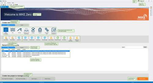
Access new tools, Cloud applications and an enhanced graphical overview from the redesigned MIKE Zero start page
MIKE Zero, DHI’s fully Windows integrated graphical user interface, is now better than ever and comes standard with all MIKE 21/3 software. Enjoy easy access to new MIKE Cloud applications and Cloud-enhanced functionality, plus an extended set of MIKE tools within theme-based (rather than product-based) interactive workflows. Ensure important model components such as sources and structures stay at the forefront with a new interactive, customisable floating mapping window. Lastly, the updated tabbing functionality will help you work in a more organised and efficient manner.
Benefit from significant enhancements to the MIKE Zero Data Extraction FM Tool
The tool now delivers improved performance through OpenMP parallelisation, enabling faster processing. Input data files can be easily viewed and validated, while output file selection has been streamlined to align with MIKE 21/3 input editors. Bathymetry can now be displayed in Geographical View, enhancing spatial understanding. Users can save 2D and 3D structured overlays as DFSU files across all modules (HD, TR, ST, MT, EL, PT), and horizontal plane outputs are now available for '3D' field types in all modules.
Let's get started
DHI PlumeCast’s user-friendly interface allows you to effortlessly enter the details of your dredging operation and initiate the simulation process. Within no time, you'll have comprehensive results at your fingertips, which can be animated for seamless visualisation and sharing with colleagues and stakeholders.
You may also like


Related technologies
LITPACK
Simulate littoral processes and coastline kinetics for effective coastal management.
MIKE 21 Shoreline Morphology
Model long-term coastal evolution to efficiently address real-world engineering challenges.
MIKE 21-3 Mud Transport
Simulate fine-grained sediment transport to analyse siltation on marine, brackish, and freshwater projects.
How can we help?
With our global network of offices, we make sure you get the right answers to your local needs. Tell us about your water challenges and we will get back to you.