
LITPACK
Accurately model coastal evolution and morphology to support effective coastal management strategies
LITPACK offers comprehensive coastal modelling tools for conducting unparalleled coastline simulations. It enables the simulation of intricate littoral processes and coastline kinetics, making it ideal for evaluating and designing coastal management strategies.
Unlike standard models, LITPACK provides detailed simulations across various profiles and coastal structures, such as groynes and breakwaters. From predicting coastline evolution to assessing the impact of coastal constructions, LITPACK serves as a robust platform for optimising coastal development and protection.
How does LITPACK help?
No in-house modellers?
Get our expert modellers on board for your consulting projects either as a partner, to provide extended user support or for model and project reviews. Submit an inquiry
Areas of application

Climate change resilience and impact
Analyse how climate change affects coastal sediment dynamics to inform adaptation strategies.

Coastal engineering studies
Improve coastal structure designs by modelling sediment transport for various constructions.

Coastal erosion strategies
Evaluate the impact of coastal development and protective schemes on sediment dynamics.
Sediment transport and morphology
Provide insights into sediment behavior including the effects of harbour siltation due to littoral drift.

Wave predictions
Use wave data to predict sediment movement and shoreline changes to enhance coastal management strategies.
Additional capabilities & unique features
Explore our latest support resources, including guides, videos, and FAQs in our Knowledge Base.
What’s new in LITPACK: 2025
Improved interpolation between cross-shore profiles
LITPACK now offers a new option to specify profile locations along the coastline using origin points from a list. This enhancement enables linear interpolation of wave and current forcings between profiles, improving the accuracy of coastline evolution calculations.
Accurately calculate littoral drift using a deterministic model approach
The core of LITPACK is the sediment transport model – a deterministic description of non-cohesive sediment transport in a single point. This enables users to accurately calculate littoral drift for a varying cross-shore profile with spatially varying grain diameters, using the actual wave and current climate.
Calculate non-cohesive sediment transport from combined wave and current action
Perform detailed calculations of sediment transport from combined wave and current action for all modules with the Transport in Point module. This ‘intra-wave period’ sediment transport model solves the vertical sediment diffusion equation on an intra-wave period grid, enabling users to output internal calculation parameters within one wave period in addition to bed load and suspended load in two directions.
Analyse sediment transport on complex coastal profiles with longshore bars
Gain insight on hydrodynamic conditions and sediment transport across the profile as well as integrated littoral drift rates for an individual wave event with the Littoral Drift module. Important effects such as the linking of the profile to the wave propagation, the wave climate to the storm surge and the variation in sediment properties across the profile are included. Use this information to optimise larger and more time-consuming models in 2D.
Run fast coastline evolution simulations with the Table Generation module
With the Table Generation module, users can generate up to eight profiles in the longshore direction. Define transport rates by interpolation in pre-generated littoral drift transport tables rather than by calculating the instant littoral drift for each location of the coastline. These tables offer numerous littoral transport rates for an envelope of hydrodynamic conditions and are generated by successive calls to the littoral transport engine.
Calculate the movements of the coastline position with respect to a straight baseline
Gain insight on the distance from the baseline to the coastline, the local littoral drift rates and accumulated transport along the coastline with the Coastline Evolution module. This module is based on a one-line theory, in which the cross-shore profile is assumed to remain unchanged during erosion/accretion. Thus, the coastal morphology is solely described by the coastline position (cross-shore direction) and eventual changes of dune geometry at a given long-shore position.
Calculate cross-shore sediment transport in shallow water
The Transport in Point module enables users to accurately calculate the time-varying water surface and orbital velocities from various wave theories. In shallow water, the wave motion becomes non-linear, e.g. the velocities under the wave crest are higher than under the wave trough, an important phenomenon in the calculation of cross-shore sediment transport.
Boost your productivity with specialised tools in the LITPACK Toolbox
The productivity tools included in the LITPACK Toolbox such as graphical editors and animated presentation of results make modelling a breeze. Users can also:
- Perform a scatter analysis of time series data with the Scatter Diagram
- Accurately describe cross-shore profile changes based on a time series of wave events using the Profile Evaluation Tool
- Calculate and tabulate transport rates for an envelope of the hydrodynamic conditions with the Table Generator Tool
Benefit from simplified data input, analysis and presentation of simulation results
Simplify the tasks of data input, analysis, and presentation of simulation results through the integrated work environment provided by the same Pre-processing and Post-processing (PP) module as MIKE 21 and MIKE 3. Plus, if you already have MIKE 21 or MIKE 3 on the same installation, you do not need an additional PP module for LITPACK.
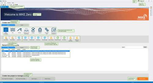
Access new tools, Cloud applications and an enhanced graphical overview from the redesigned MIKE Zero start page
MIKE Zero, DHI’s fully Windows integrated graphical user interface, is now better than ever! Enjoy easy access to new MIKE Cloud applications and Cloud-enhanced functionality, plus an extended set of MIKE tools within theme-based (rather than product-based) interactive workflows. Ensure important model components such as sources and structures stay at the forefront with a new interactive, customisable floating mapping window. Lastly, the updated tabbing functionality will help you work in a more organised and efficient manner.
Available on Azure Marketplace
You can now access LITPACK on Azure Marketplace, where you can start modelling in the cloud with no hardware limitation in four simple steps. Learn more
Improved interpolation between cross-shore profiles
LITPACK now offers a new option to specify profile locations along the coastline using origin points from a list. This enhancement enables linear interpolation of wave and current forcings between profiles, improving the accuracy of coastline evolution calculations.
Let's get started
Learn how your project can benefit from integrated littoral processes and coastline kinetics modelling software.


Related technologies
MIKE 21 Shoreline Morphology
Model long-term coastal evolution to efficiently address real-world engineering challenges.
MIKE 21-3 Mud Transport
Simulate fine-grained sediment transport to analyse siltation on marine, brackish, and freshwater projects.
MIKE 21-3 Sand Transport
Simulate the impact of sedimentation on ports, offshore energy, dredging, and coastal engineering.
How can we help?
With our global network of offices, we make sure you get the right answers to your local needs. Let us know what you're interested in (e.g., product features, trial license, pricing, etc.) and we will get back to you.