
MIKE 21 and MIKE 3
Supercharge your marine water modelling projects
MIKE 21 and MIKE 3 are advanced software suites for simulating and analysing water flow, currents, wave conditions, and processes in marine and coastal environments. With robust visualisation tools and data management capabilities, these software solutions empower users to effectively interpret simulation results. Widely embraced by engineers, scientists, and environmental professionals, they find application in coastal engineering, water resource management, environmental impact assessment, and climate change adaptation planning.
MIKE 21 specialises in two-dimensional (2D) modelling, offering precise simulations of water flow and movement in coastal areas, estuaries, and rivers. It enables accurate predictions of water levels, currents, temperature variations, and flood occurrences, excelling in managing intricate bathymetry and external forces like wind effects.
Conversely, MIKE 3 extends hydrodynamic modelling capabilities into three dimensions (3D), providing an exhaustive understanding of water flow dynamics. It addresses phenomena such as wave-induced currents, storm surges, and weather-related influences, proving indispensable for detailed environmental evaluations, particularly in complex marine settings.
Why choose MIKE 21 or MIKE 3?
Choose the modules that best suit your needs
Pick and choose from a selection of modules that target specific concerns. Alternatively, pre-bundled software subscriptions provide great value.
Marine PP, Hydrodynamics, and Transport

Marine Pre & Post-Processing
Start your data visualisation journey with Marine Pre & Post-Processing (PP), an integrated environment within MIKE Zero for easy data input, analysis, and result presentation.
- Generate boundary conditions quickly and easily
- Create and edit 2D/3D grids and detailed computational meshes
- Animate results in Google Earth and create amazing 3D video presentations
- Speed up model creation with access to digital bathymetric data
- Enhance productivity with sensitivity analysis and auto-calibration features
- Access data in MATLAB, Python, QGIS and other programming languages
See the MIKE Zero Pre & Post-Processing User Guide for full details.

Hydrodynamics
The Hydrodynamic (HD) module solves the equations for the conservation of mass and momentum as well as for salinity and temperature in response to a variety of forcing functions.
- Specify a variety of hydrographic boundary conditions, initial conditions, bed resistance and wind forcing
- Include different types of sources and sinks as well as different structures
- Treat density variations in different manners
- Include radiation stresses from wave simulations
- Choose from rectangular grid, nested grids or flexible meshes
- Seamlessly integrates with other modules for coupled modelling
See the MIKE 21 HD User Guide and MIKE 3 HD User Guide for full details.

Transport
Rely on the Transport (AD) module to quickly assess your water quality concerns by simulating the spreading and fate of tracers, dissolved, or suspended matter.
- Describe the temperature, salinity, and density of substances subject to linear decay and heat dissipation
- Analyse complex discharges via connected source-sink dynamics to understand re-circulation or variations in habitat quality
- Identify zones of accumulation and poor flushing using multiple tracers to support water quality screening
- Integrate with MIKE ECO Lab for modelling eutrophication, coliform bacteria fate, and heavy metal compounds
See the MIKE 21 Transport User Guide and MIKE 3 Transport User Guide for full details.
Ecological & water quality modelling

ABM Lab
2D/3D agent-based modelling
Simulate the dynamic behaviour and environmental interactions of aquatic life.

MIKE ECO Lab
1D/2D/3D ecological modelling
Investigate water quality concerns and their potential environmental impact

Particle Tracking
2D/3D particle transport modelling
Understand and quantify pathways and impacts in your environment

Oil Spill
2D/3D oil spill modelling
Quantify and visualise the risks and potential impact of oil spills
Sediment transport & morphological modelling

LITPACK
Littoral processes & coastline kinetics
Simulate the evolution of coastlines affected by structures and sedimentation

Mud Transport
2D/3D mud transport modelling
Study the impact of siltation on coastal morphology and water quality

Shoreline Morphology
2D morphological modelling
Model long-term shoreline evolution in areas with complex bathymetries

Sand Transport
2D/3D sand transport modelling
Assess the potential impact of erosion and sedimentation on infrastructure
Wave modelling & dynamic mooring analysis

Boussinesq Waves
2D wave modelling
Analyse wave disturbances in ports, harbours and coastal areas

MIKE 3 Wave FM
3D phase resolving wave modelling
Study the impact of a wave climate on offshore, coastal or port infrastructure

Mooring Analysis
Dynamic mooring analysis
Assess the dynamic effects of wind, currents and waves on moored vessels

Spectral Waves
2D spectral wind-wave modelling
Predict and analyse wave climates in offshore and coastal areas
'We have been working with the MIKE 21/3 model suite since early 2006. Over the years, many of our researchers and graduate students have taken advantage of these cutting edge models to resolve the complex hydrodynamic and sediment transport problems pertaining to their research projects.'
Felix Jose Ph.D, Associate Professor
Florida Gulf Coast University (USA)
Additional capabilities & unique features
Explore our latest support resources, including guides, videos, and FAQs in our Knowledge Base.
Enhanced hydrodynamic calculations
Experience enhanced stability for both higher-order and low-order schemes, particularly in regions involving flooding and drying, with notable advantages for three-dimensional simulations. The fast low-order scheme has undergone substantial enhancements in accuracy and stability, especially in areas with steep gradients. Consequently, velocities along riverbanks and underwater channels now exhibit better alignment with the more accurate higher-order scheme. Furthermore, the performance of GPU solvers has been optimised for simulations that incorporate infrastructure features and flow-dependent bed resistance.
Improved advection-dispersion calculations
The accuracy of our advection-dispersion scheme has been improved with an upgraded discretisation of the diffusion terms.
Run fast simulations in more applications with improved core numerics
Coastal and marine modellers – run faster, more accurate FM simulations in more applications with improved numerics. Plus, avoid freak (unnatural) velocities and numerical noise, particularly when modelling steep gradients such as riverbanks and shelf seas.
Explore new modelling possibilities and streamline your workflows
Users can now calculate excess temperature in desalination plants, more accurately assess flooding with an H4Inundation output on line series, and even run degree-based map projections thanks to the removal of LONG/LAT dependency in the FM engine(s). Experience faster GPU acceleration, particularly during the initialisation phase for shapefiles that include thousands of polygons.
Integrate vegetation into your coastal defence strategies and coastal zone management planning
Salt marsh and mangrove vegetation, which cover ~19% of our global coastline, are paramount in helping to reduce climate change-related risks along the coastline. Particularly when used in combination with other natural or man-made coastal defences, belts of coastal vegetation can help reduce damage and associated costs from waves, intense storms, tsunamis, erosion, and sea-level rise.
To better support coastal zone management planning and coastal defence initiatives, MIKE 21 Flow Model FM, MIKE 3 Flow Model FM and MIKE 3 Wave FM models can be used for a variety of vegetation – from rigid plants like mangroves to flexible plants such as salt marsh cover. In addition, MIKE 21 Spectral Wave FM also includes two new dissipation models for rigid plants: a multi-layered approach for the fully spectral formulation and directionally decoupled parametric formulation and a single-layered approach for the fully spectral formulation.
Model complex hydrodynamics and scour with accurate turbulence modelling
MIKE 3 Flow Model FM users now have access to a k-Omega turbulence model with wall functions to model vortices and vortex shedding around vertical structures such as slender piles. When coupled with a MIKE 21/3 Mud Transport or a MIKE 21/3 Sand Transport model, you can more accurately predict scour around structures. Watch video
Model in the cloud with Azure Marketplace
You can now access MIKE 21 and MIKE 3 on Azure Marketplace, where you can start modelling in the cloud with no hardware limitation in four simple steps. Learn more
Couple modules for advanced studies
Need to analyse problems where flow and transport phenomena are important and where the flexibility inherited in the unstructured meshes can be used? Look no further than MIKE 21 and MIKE 3 Coupled Model FM. With this truly dynamic modelling system, you have the power to investigate the morphological evolution of nearshore bathymetry impacted by factors such as dredging works and engineering structures, including breakwaters, groins, shoreface nourishment, and harbours.
Rely on this to:
- Dynamically couple waves and currents
- Get full feedback on bed level changes to waves and currents
- Easily switch between 2D and 3D calculations (hydrodynamic module and process modules)
- Achieve flexibility in describing bathymetry, ambient flow, and wave conditions using depth-adaptive and boundary-fitted unstructured mesh
Enhance your modelling with first class tools
Set up simulations, perform pre- and post-processing analysis, and present and visualise results with MIKE Zero, our fully Windows integrated graphical user interface embedded in MIKE 21 and MIKE 3. With MIKE Zero, you can better control and organise information for nearly all kinds of engineering studies including model simulations. Streamline your work with access to a wide range of informative and helpful features.
Run fast simulations for quicker results
MIKE 21 and MIKE 3 take advantage of the efficient parallelisation techniques for the use of multiple cores and GPUs. Special techniques have also been developed to enhance calculation speed within the morphological modelling.
Clearly communicate your results with powerful visualisation tools
Regardless of how efficient your modelling is, clear communication of results is crucial to its value and recognition. With MIKE 21 and MIKE 3, you can:
- Create time series, line series, and 2D/3D data plots
- Display flexible mesh model data
- Visualise cross-sections, individual particles and tracks
- Enhance your models with detailed digital bathymetries
- Animate gridded and unstructured results in Google Earth
- Create realistic 3D scenes, including buildings, ships, or other solids, visualise waves in 3D, produce professional fly-through animations and more with MIKE Animator Plus – included in all subscription packages.
Model a variety of subgrid features to understand the effects of structures
Model the effect of structures using a subgrid technique. Include six different types of structures in your simulations:
- Weirs
- Culverts
- Dikes
- Gates
- Piers
- Turbines
You also have the option to include composite structures by combining a weir and one or more culverts.
Master the software in no time
Get the most value from your software and reduce project risk with a variety of training options and technical support.
- Get instant answers through the integrated Online Help System that provides context-sensitive support for every property, dialog and editor
- Learn at your own pace with self-paced and blended training courses
- Watch a pre-recorded webinar or register for a live webinar
- Join one of our instructor-led online courses
- Take advantage of customised in-house training to get your projects moving faster
- Receive a response from technically competent Support staff
- Access a library of Frequently Asked Questions
Run your models on LINUX
The computational engines of MIKE 21 and MIKE 3 are also available on Linux operating systems taking advantage of access to 100’s of CPU’s.
Get more done in less time with the modernised MIKE Zero user interface
Save time and improve your modelling workflows using MIKE Zero’s upgraded editors and viewers. Take advantage of new keyboard shortcuts and themes, improved tabbing, tear off and cascade functionality plus easier access to User Guides and Scientific Documentation.
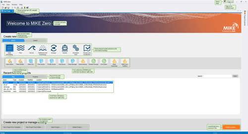
Access new tools, Cloud applications and an enhanced graphical overview from the redesigned MIKE Zero start page
MIKE Zero, DHI’s fully Windows integrated graphical user interface, is now better than ever and comes standard in all MIKE 21 and MIKE 3 software! Enjoy easy access to new MIKE Cloud applications and Cloud-enhanced functionality, plus an extended set of MIKE tools within theme-based (rather than product-based) interactive workflows. Ensure important model components such as sources and structures stay at the forefront with a new interactive, customisable floating mapping window. Lastly, the updated tabbing functionality will help you work in a more organised and efficient manner.
Benefit from significant enhancements to the MIKE Zero Data Extraction FM Tool
The tool now delivers improved performance through OpenMP parallelisation, enabling faster processing. Input data files can be easily viewed and validated, while output file selection has been streamlined to align with MIKE 21/3 input editors. Bathymetry can now be displayed in Geographical View, enhancing spatial understanding. Users can save 2D and 3D structured overlays as DFSU files across all modules (HD, TR, ST, MT, EL, PT), and horizontal plane outputs are now available for '3D' field types in all modules.
Streamline post-processing with miscellaneous enhancements to the MIKE Zero Data Viewer tool
The tool now allows users to reproject mesh files directly within Data Viewer, simplifying workflows. Polygon selection areas can be saved and loaded to streamline manual post-processing, and the area of selected elements within a polygon can be viewed for increased efficiency. Time series point locations can also be saved and loaded, complemented by additional visual improvements. Transect visualisation has been significantly enhanced to provide clearer insights.
New additions to the MIKE Zero Toolbox Statistics Group
The DFSU Vertical Statistics tool has been introduced, replacing the hidden DataVerticalAveragingFM.exe. It supports calculations for maximum, minimum, and mean values, though some non-essential functions have been removed, making it not fully backward compatible. Additionally, the DFSU Statistics tool merges the capabilities of DataStatisticsFM.exe and DataExceedanceFM.exe. This tool offers calculations for maximum, minimum, mean, standard deviation, exceedance, and percentiles, with the percentile feature being entirely new. However, it is not backward compatible for exceedance calculations. Note that the hidden tool DataExceedanceFM.exe will be retired in MIKE Zero 2025.
Enhanced resizable properties dialogs in the MIKE Zero Data Viewer and Plot Composer
The Properties dialogs for both Time Series Plot and Profile Plot are now resizable, providing greater flexibility. Additional improvements to the properties tables include tool tips that display full field information, such as file name and path. Users can also double-click a header to resize individual columns or double-click the index field to resize all columns for a more efficient and customisable experience.
New Split View Comparison in MIKE Zero Results Reviewer
The Results Reviewer now features a slider-based 'Split View Compare Files' function, allowing you to compare two files side-by-side for easier analysis and better comparison of results.
Let's get started
Learn how your projects can benefit from the most advanced 2D and 3D software suite for modelling the coast and sea.


